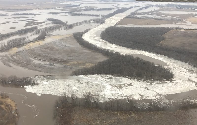
On Friday, February 23, 2018, Whiteside County Sheriff’s Office Sergeant Seth Janssen “provide the following relevant information, regarding the current ice jams between Erie, and Prophetstown, IL. I’ve also attached a couple of photos I took, with the assistance of the Illinois State Police Air Operations,” he noted. Sergeant Janssen is the Whiteside County Emergency Services and Disaster Agency (ESDA) Coordinator.
“There are currently two sections of the [Rock R]iver between Erie and Prophetstown experiencing ice jams. The first jam extends from approximately one mile downstream from the IL Route 78 bridge to Thunder Road.”

“The second jam extends from approximately Smit Road to about two miles upstream from the Erie Road bridge.”

“This equates to roughly six miles of jammed up ice still to make it down the river. With the water falling in Prophetstown throughout the day, and holding essentially steady in Erie, it appears the water is finding its way through/around/under the current ice jams. Thus, any sudden changes in the movement of that ice could result in rapid fluctuations in the river levels in the near future. This is still a serious situation that can change very quickly.”