2004 Year in Review
Back to Homepage: Local Issues Listing | Back to Year in Review Index
Route 30 Corridor Meeting |
|
|
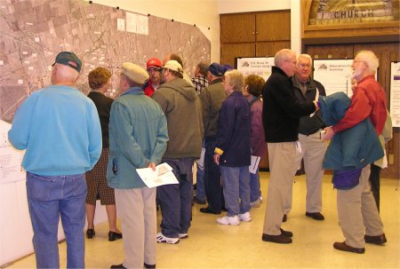
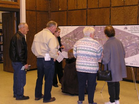
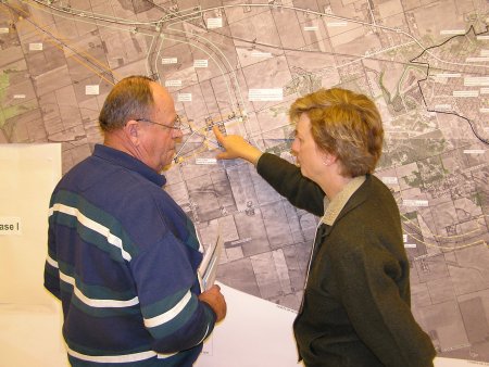
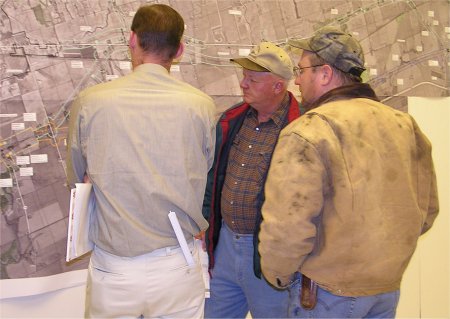
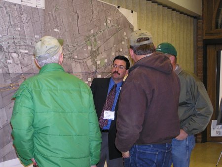
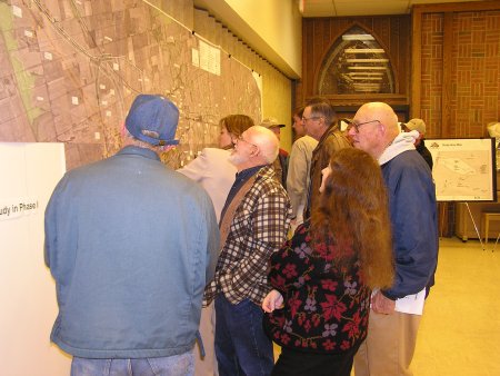
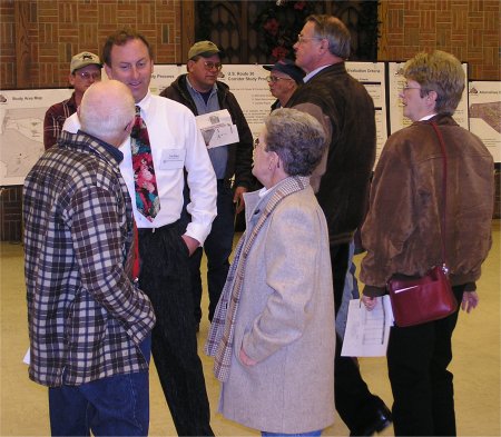
A crowd of Whiteside County landowners attended an Open House informational meeting Thursday with officials from the Illinois Department of Transportation to find out how the states route alternatives involving the U.S. Rt. 30 Corridor Study would impact their land. According to the attendance sheets, 253 people signed in at the registration desk. Large maps covered the walls at Morrison United Methodist Church showing the routes. The first public meeting held April 27, 2004 outlined four possible routes. Two were north of Morrison and two went south of Morrison. After continued studying and evaluating comments from the April 27th meeting, two additional alternate routes have been created. Corridor Alternative #5 includes constructing an expressway that utilizes more of existing US 30 and traverses around the central business district of Morrison to the north. This corridor alternative is approximately 22.4 miles in length and crosses Illinois Route 78 approximately 1.2 miles north of the center of the City of Morrison. Corridor Alternative #6 includes constructing an expressway that utilizes more of the existing US 30 and traverses the central business district of Morrison to the south. This corridor alternative is approximately 23.2 miles in length and crosses Illinois Route 78 approximately 1.4 miles to the south of the city center. Two steps of the project process have been completed. The first step being, the Project Need, which identified the need for a particular project from local agencies, businesses and residents and state highway officials. Safety is our number one concern, stated Jon McCormick, IDOT representative. With increased traffic numbers examined the U.S. Route 30 Corridor Study began in the spring of 2003. Right now the study is in Step 2, which is the Feasibility or the Corridor study. During this step in the study the following questions are looked into: - Will a new highway accommodate economic development in a certain region of the State and create more benefits than costs, or would upgrading existing highways be a better solution for satisfying State and Local needs?
Those attending the meeting were encouraged to submit written comments about the study. Each comment is read individually and responded to, noted McCormick. We look for similarities and concerns in the comments and questions about the access to specific properties are kept in record. Federal funding is used for these studies not state money, commented McCormick. When the funding becomes available we will proceed with the next step of the study which is Phase 1: Preliminary Design and Environmental Evaluation. "There were three corridor alternatives (3B,3C, and 6) recommended for further evaluation in the Phase I study," stated Steve Mendoza, Project Engineer for IDOT. During this step the selected corridors would be studied in more detail and a preliminary design for alternatives developed. Pending further funding, Construction Plans right-of-way plans, acquisition, construction bids and construction could follow for a single preferred alternative. Comments will be accepted through December 30, 2004 and can be addressed to Deputy Director of Highways, Region Two Engineer, Illinois Department of Transportation 819 Depot Avenue, Dixon, IL 61021. Information is available at IDOT Project Website A summary of the meeting is shown at Meeting Summary Alternative Evaluation Criteria is available at Evaluation Criteria A map is shown at Map by Dawn Zuidema, theCity1.com |
Copyright © 2004 TheCity1.com.
All rights reserved